

DigitalPlant
An advanced tool for integrated air‑quality management
DigitalPlant merges environmental monitoring with forecasting models and machine‑learning techniques to provide an advanced decision‑support system able to identify and prevent environmental issues in real time, both in the short and medium term.
Its main application areas include urban environments, industrial facilities, and natural or environmental areas.
Key Features
DigitalPlant includes a dashboard for real‑time data consultation, offering a compact overview that enables a complete and rapid assessment of the context.
The platform can assimilate data from existing networks composed of different device types. If needed, our team can provide full support in selecting devices and configuring the monitoring network.
The platform has been developed by leveraging years of experience in environmental consulting. Collected data undergo preliminary statistical processing and are presented to users clearly and effectively.
Collected data are continuously processed to identify unusual or anomalous conditions in the monitored context. DigitalPlant interprets the concept of thresholds through an innovative approach:
- Multiparametric (considering correlations among observed variables)
- Multisite (comparing data from different nodes of the monitoring network)
- Time‑extended (evaluating temporal trends of variables)
When a critical event occurs, the first question concerns its origin. Using continuously produced meteorological data from operational models and/or sensor measurements, back‑trajectory models can be immediately activated to reconstruct past conditions and estimate the origin of the measured air mass.
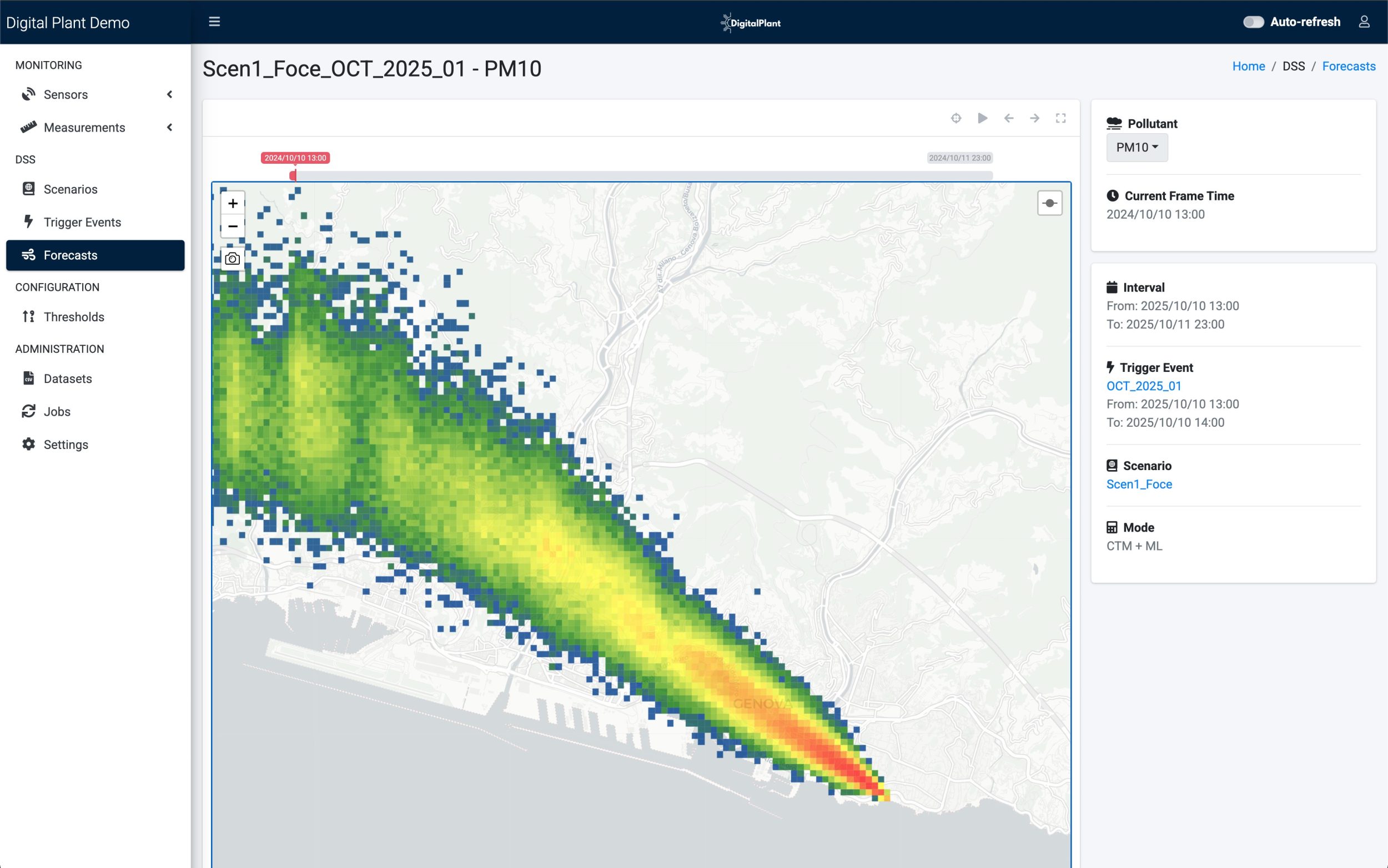
Punctual and instantaneous identification provides only a partial view. Evaluating temporal evolution allows verification of potential fallout and short‑/medium‑term impacts of different emission sources. The platform is pre‑configured with typical scenarios simulated through atmospheric‑dispersion models with a 24–48‑hour time horizon and spatial extent tailored to user needs.
A key limitation of atmospheric‑dispersion models is the uncertainty in defining simulated emission sources, which are often based on arbitrary statistical assumptions. To overcome this and ensure full consistency with monitoring‑network observations, outputs from forecasting models are calibrated by projecting observed data into the future using machine‑learning algorithms.
DigitalPlant is designed to automatically and promptly provide all information needed to prevent environmental issues. Identifying an event through a detailed monitoring system is essential to highlight its potential consequences. Knowing the origin of the issue helps determine which stakeholders may need to intervene and how corrective actions should be configured or scaled. Territorial administrators can evaluate the most relevant measures, while operators of potentially impactful activities can assess their contribution and identify areas and methods for intervention.


Application Contexts
Industrial Applications
- Assess real‑time emissions from industrial plants by integrating data from internal or territorial monitoring networks.
- Identify and characterize point, diffuse and fugitive sources, distinguishing industrial emissions from other territorial sources through retrospective models and multiparametric analyses.
- Activate customized early‑warning systems capable of automatically signaling anomalies or threshold exceedances and supporting timely corrective actions.
- Optimize operational efficiency by minimizing unnecessary interventions thanks to the ability to distinguish internal events from external contributions and evaluate the real evolution of impacts in the short and medium term.
- Monitor and assess odor impact, enabling timely and targeted mitigation actions and supporting citizen‑reported complaints with scientifically robust analyses.

Urban Applications
- Continuous monitoring of large urban areas through heterogeneous sensor networks integrated into a single information system.
- Identification of predominant sources using air‑trajectory reconstruction models and advanced statistical analyses.
- Support for technical and administrative planning through forecasting models that estimate the evolution of emission scenarios and help evaluate the potential effectiveness of mitigation measures (traffic restrictions, emission‑control policies, urban planning).
- Early warning and public communication, with the ability to provide reliable information to citizens via dashboards, public portals or territorial alert systems.

Port Applications
- Continuously monitor air quality within the port area, integrating data from dedicated sensors, existing stations and meteorological sources.
- Assess the impact of port activities on surrounding territories, distinguishing contributions from maritime traffic versus urban or industrial sources.
- Identify predominant sources through retrospective models, useful for determining the contribution of specific docks, operational phases, storage areas, construction sites or moving vehicles.
- Support mitigation plans, shore‑power strategies, operational control and intervention planning based on continuously updated information recalibrated through machine‑learning algorithms.

Tourism and Hospitality Applications
- Assess and certify air quality in naturalistic or tourist‑oriented areas through continuous monitoring and easily accessible indicators.
- Support sustainable‑management processes by helping administrations, park authorities and operators identify critical dynamics linked to tourism flows, transportation or local activities.
- Provide transparent information to visitors through public dashboards, on‑site displays or app‑based notifications.

