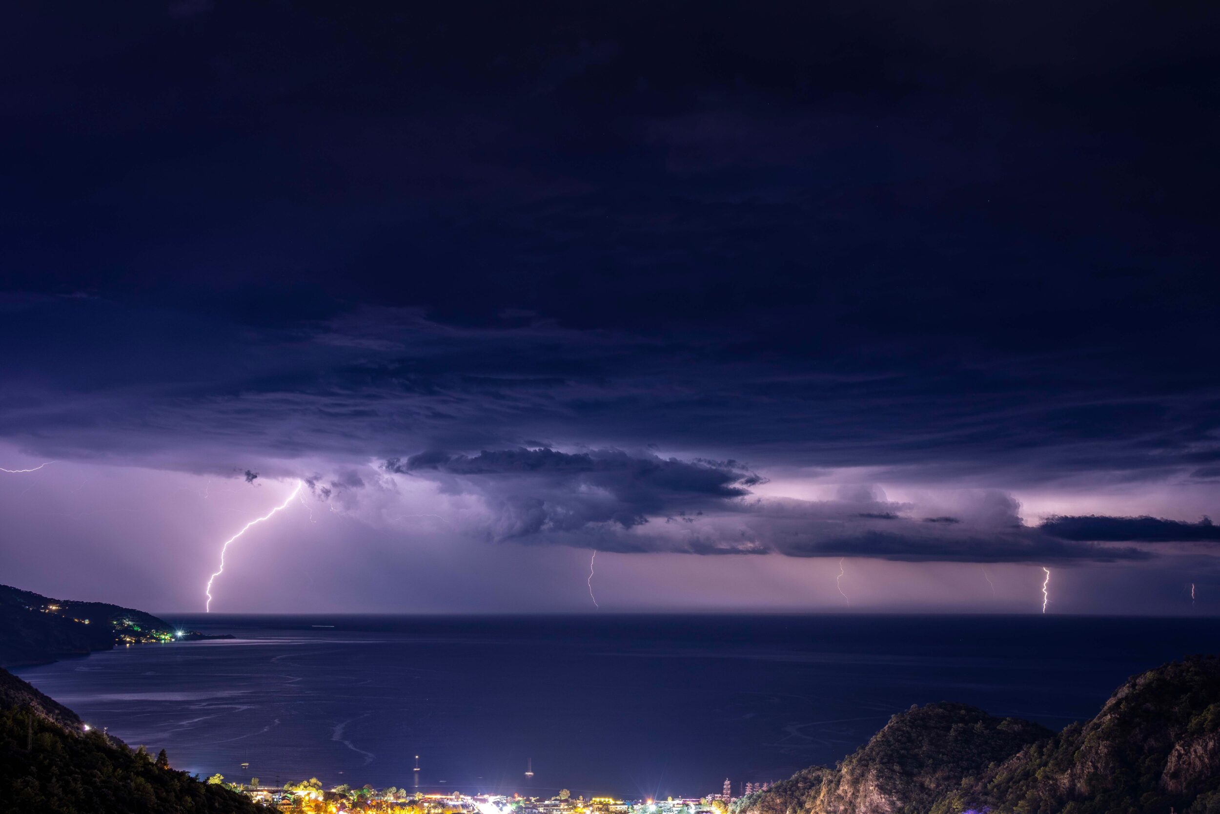
Extreme weather events are high-intensity atmospheric phenomena that can have significant impacts on people, infrastructure, and economic activities. For businesses and organizations, they represent a tangible operational risk, as they can compromise worker safety, disrupt operations, and damage critical assets and infrastructure.
For years, PM_TEN has supported companies, public authorities, and infrastructure operators through advanced weather modelling services, risk analysis, and early warning systems. Understanding and predicting convective phenomena such as lightning and hail is now essential for implementing effective preventive measures, optimizing operational decisions, and improving organizational resilience. In this article, we explore why these phenomena are particularly difficult to predict, which activities depend on reliable forecasting, and how the latest approaches combining meteorological models and artificial intelligence are extending the useful lead time of warning systems.
Extreme weather events: why they represent an operational risk
Extreme weather events are atmospheric phenomena characterized by high intensity and the potential to cause significant damage over short periods of time. Extremes may involve individual weather events, such as exceptionally heavy rainfall, or conditions that persist for longer periods, such as an unusually dry season. They should not be confused with climate trends, which describe how climate characteristics change over time.
In the language of risk management, these events fall within the category of acute physical risks, one of the components of climate risk considered by the European Taxonomy and ESRS reporting standards.
Among extreme weather events, lightning and hail deserve particular attention because they develop rapidly, often affect highly localized areas, and can impact industrial activities, energy infrastructure, construction sites, agricultural operations, and logistics networks.
In Italy, the observation of these phenomena relies on complementary monitoring tools, including lightning detection networks, weather radars, and ground-based stations. These are complemented by the European Severe Weather Database (ESWD), which collects and quality-controls reports of severe weather events, including hailstorms and lightning-related damage.
Lightning and hail: the physical mechanisms in brief
How lightning forms
Lightning develops inside thunderstorm clouds, typically cumulonimbus clouds, through a process of electrical charge separation. Collisions between graupel particles (soft hail), ice crystals, and supercooled water droplets (liquid water that remains unfrozen at temperatures below 0 °C) transfer electrical charge between particles. Updrafts then separate lighter particles from heavier ones, creating regions of opposite charge within the cloud.
When the local electric field becomes sufficiently strong, an electrical discharge is initiated. This discharge may occur within the same cloud, between different clouds, or between the cloud and the ground.
How hail forms
Hail develops within strong thunderstorm cells characterized by intense updrafts. Hailstones originate from graupel particles that are carried aloft above the freezing level, where the atmosphere contains supercooled water droplets. As these droplets collide with the particle, they freeze onto its surface, allowing it to grow layer by layer.
Once the hailstone becomes too heavy for the updraft to support, it falls to the ground. The most severe hailstorms are often associated with supercells, highly organized thunderstorms featuring strong and persistent rotating updrafts that allow hailstones to remain in the growth region for extended periods.
To assess how favourable atmospheric conditions are for the development of severe thunderstorms, forecasters consider, among other parameters, CAPE (Convective Available Potential Energy), which measures the energy available to sustain updrafts, and vertical wind shear, that is, the variation of wind speed and direction with altitude. Wind shear strongly influences thunderstorm organization, intensity, and duration. While these parameters help identify favourable conditions, they do not by themselves determine whether or where lightning or hail will actually occur.
The impact on safety, business continuity and assets
| Sector | Lightning Exposure | Hail Exposure | Decision to Anticipate | Useful Lead Time |
|---|---|---|---|---|
| Agriculture | Outdoor workers, equipment and installations | Crops, greenhouses and exposed equipment | Deploy available protection measures and reschedule outdoor activities | Hours or days to prepare; minutes for immediate actions |
| Construction and Work at Height | Personnel, scaffolding, cranes and exposed structures | Workers, temporary coverings and materials | Reschedule activities and secure the construction site | Hours or days to organize; minutes to suspend activities |
| Energy and Utility Networks | Power lines, electrical facilities and maintenance personnel | Solar panels and exposed components | Adjust maintenance schedules and prepare response teams | Hours or days |
| Ports, Maritime Operations and Logistics | Outdoor personnel, cranes, vessels and facilities | Vehicles, goods and exposed equipment | Reorganize handling operations and interventions, prepare shelter for personnel | Hours to organize; minutes for immediate actions |
| Public Events and Civil Protection | People in open spaces and temporary structures | People, installations and equipment | Assess postponements, prepare shelters and activate safety procedures | Hours or days to plan; minutes for immediate actions |
Lightning risk assessment: what it covers and what it does not
Lightning risk assessment is a requirement under the Italian regulatory framework for occupational health and safety, as part of risk assessment procedures and the technical standards of the CEI EN 62305 series.
This assessment makes it possible to estimate the risk associated with the direct and indirect effects of lightning strikes on buildings, facilities and people, and to identify any necessary protection measures.
However, it has an important limitation: it provides a statistical and structural assessment of risk but is not designed to support day-to-day operational decisions related to the imminent arrival of a thunderstorm. To effectively protect outdoor workers, lightning risk assessment must therefore be complemented by forecasting services and timely warning systems.
Predicting convective phenomena: from numerical models to nowcasting
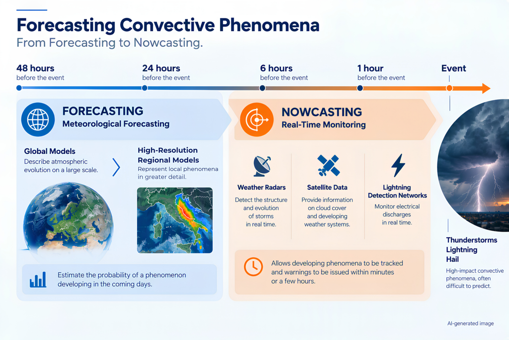
Modern weather forecasting is based on a combination of numerical models and real-time observations. Global models, such as those developed by the European Centre for Medium-Range Weather Forecasts (ECMWF), describe atmospheric evolution on a large scale. Subsequently, high-resolution limited-area models, such as the WRF model, which forms the basis of PM_TEN’s operational forecasting modelling chain, make it possible to represent regional and local phenomena in greater detail.
Despite continuous improvements, lightning and hail remain among the most difficult weather hazards to predict. Their development depends on highly complex convective processes occurring on very small spatial and temporal scales.
For very short-term forecasting, nowcasting techniques are used. These integrate weather radar data, satellite observations and lightning detection networks. This approach is effective for tracking thunderstorms that are already developing and issuing warnings within minutes or a few hours, but it does not provide sufficient lead time for planning many operational activities.
Weather forecasting estimates the probability that a phenomenon will develop in the coming days, while nowcasting follows its evolution during the final minutes and hours before the event occurs.
When evaluating a forecasting system, it is useful to consider several key performance indicators:
- Recall: the ability to correctly identify events that actually occur.
- Precision: the percentage of correct warnings among all issued warnings.
- False Alarms: warnings issued for events that ultimately do not occur.
The challenge is to maximize recall and precision while minimizing false alarms.
Artificial intelligence and physical models: Flashnet‘s hybrid approach
To overcome the limitations of traditional forecasting methods, a new approach has emerged in recent years that combines the robustness of physically based models with the learning capabilities of artificial intelligence.
One example is FlashNet, a system developed by the Department of Civil, Chemical and Environmental Engineering (DICCA) of the University of Genoa in collaboration with ARPA Liguria, and described in a paper published in Nature Communications. The model uses deep learning techniques to identify the optimal relationship between meteorological variables predicted by numerical models and the actual occurrence of lightning. The study demonstrated that the hybrid approach can significantly improve the performance of traditional forecasting systems. In particular, the model achieved recall values close to 95% during the first 24 hours of the forecast period, outperforming the deterministic reference method.
“The idea behind FlashNet is to make atmospheric physics and artificial intelligence work together. Meteorological models describe the evolution of atmospheric conditions, while the neural network learns how those conditions translate into lightning occurrence. In our study, this integration improved forecasting skill up to two days ahead compared with the reference method. The practical benefit is the ability to prepare activities and protection measures before a thunderstorm becomes imminent.”
Explains Andrea Mazzino, Professor at the University of Genoa, founding partner of PM_TEN and senior author of the study published in Nature Communications.
The capabilities described in the study are now being applied operationally through the integration of FlashNet into PM_TEN’s advanced weather forecasting systems.
The next frontier: AI-based hail forecasting
Following the success achieved in lightning forecasting, research is now expanding to hail prediction.
The research group at the Department of Civil, Chemical and Environmental Engineering of the University of Genoa has developed an approach that combines meteorological forecasting and artificial intelligence to identify atmospheric conditions favourable to hail-producing thunderstorms up to two days in advance.
To learn these relationships, the system uses satellite observations capable of detecting signals associated with the presence of large ice particles within clouds, including over marine areas where ground-based observations are limited. Once trained, the model produces hourly forecasts using only meteorological model outputs, without requiring additional satellite observations.
The results, described in a study currently being finalized and independently verified through hail reports collected at ground level, show improved performance compared with traditional approaches based on atmospheric indices. This opens up a practical opportunity to support the protection of crops, infrastructure and exposed activities.
Integrating forecasts into decision-making processes
An effective forecast creates value only when it is translated into concrete action.
In agriculture, a forecast indicating a high probability of hail can trigger procedures to protect the most vulnerable crops. On construction sites, it can lead to the rescheduling of work at height. In the energy sector, it can support the postponement of planned interventions on exposed infrastructure. Within port logistics and offshore operations, it can inform preventive decisions that protect both personnel and equipment.
For this reason, the most advanced organizations integrate meteorological information into their risk management processes, emergency plans and business continuity systems.
By combining advanced meteorological modelling, artificial intelligence and warning systems, solutions such as FlashNet transform weather forecasts into practical operational tools that support safety and business continuity.
Would you like to learn how to integrate lightning and convective weather forecasts into your decision-making processes? Contact the PM_TEN team and discover the capabilities of FlashNet.